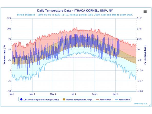
The Regional Climate Centers (RCC) Applied Climate Information System (ACIS) offers interactive temperature and precipitation charts with single- or multi-station capabilities.
HPRCC produces daily climate maps using data from the Applied Climate Information System (ACIS). The maps and data can be accessed and downloaded from the HPRCC website.
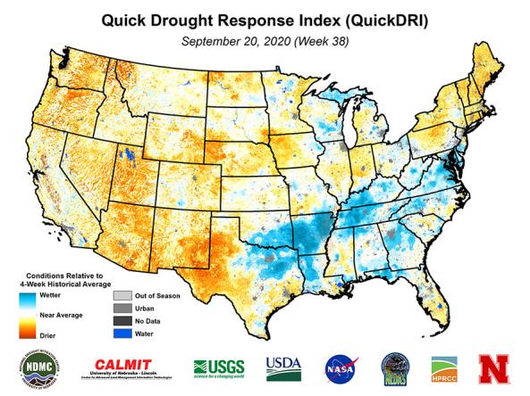
Quick Drought Response Index (QuickDRI): a geospatial tool that characterizes the intensification of short-term drought condition patterns on a weekly basis across the continental United States (CO
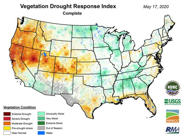
VegDRI: a weekly depiction of vegetation stress across the contiguous United States.

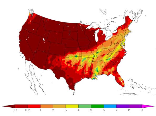
The High Plains Regional Climate Center’s Water Deficit Trends tool provides information on long-term changes in precipitation across the country.